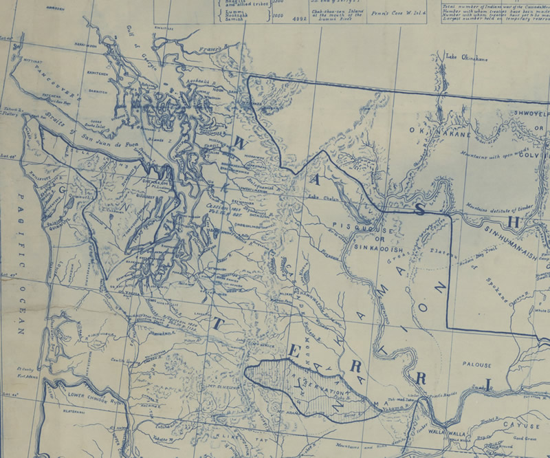
Map of the Indian Nations and Tribes of the Territory of Washington (1857)
Map of the Indian nations and tribes of the territory of Washington and of the territory of Nebraska west of the mouth of the Yellowstone. Made under the direction of Isaac I. Stevens, governor. of Washington Territory and Superintendent of Indian Affairs, March 1857, drawn by William H. Carlton, surveyor and top engineer. (1857) This image may be downloaded or reproduced for research and educational purposes without prior permission; please give credit to the University of Washington Libraries Manuscripts, Special Collections, University Archives Division. Any commercial use of this material is prohibited without prior permission from the University Libraries.